September 2015 Ag Weather Roundup

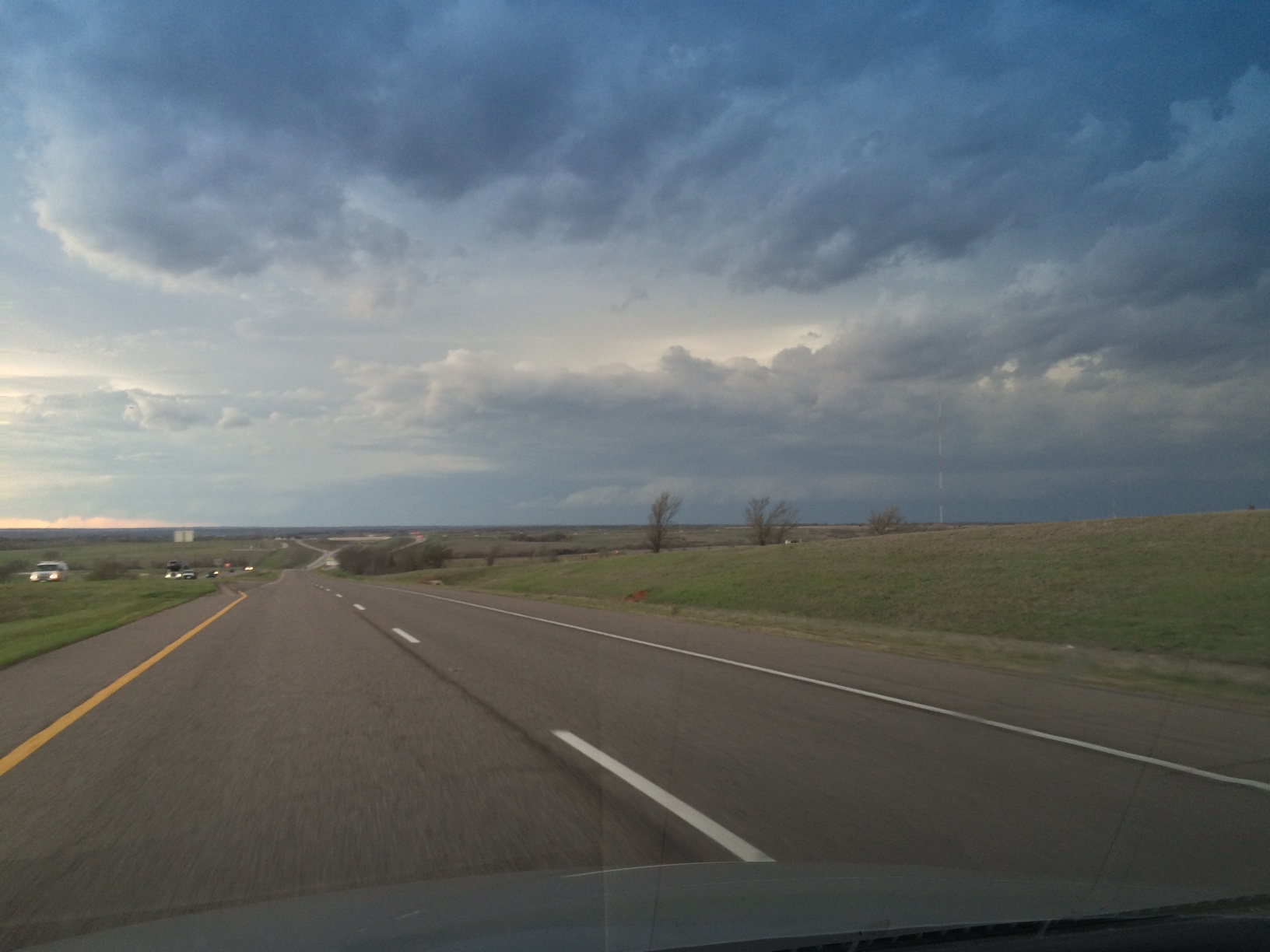
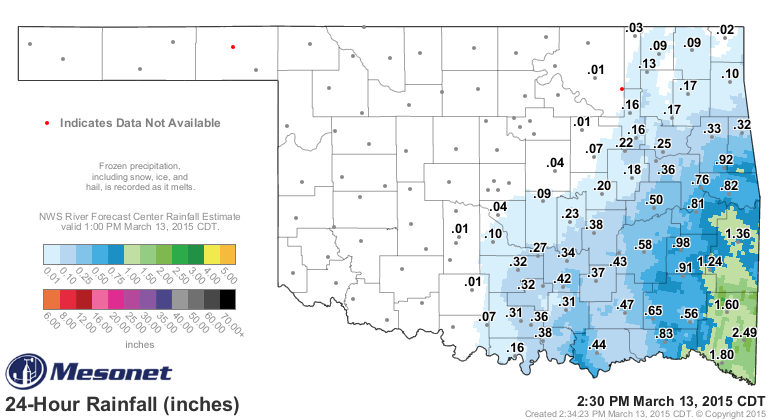
Farmers roll the dice every year when they plant. Remember back to all those rains in May. Those rains came right when it was time to get summer crops like cotton, sorghum, sesame, peanuts, watermelons, and okra planted. No worries about late planting a crop like okra, since it’s harvested continuously as young pods. For all of the other crops, late planting is a gamble with fall weather and crop maturity.

Dice in hand.Huffington Post

Continue reading

Wet Bulb Globe Temperature: What It Is and How To Use It

Wet bulb globe temperature! Say that tongue-twisting name three times and you’ll likely see anyone close by inch away, then cut and run. But knowing what wet bulb globe temperature is and how to use it is important. It can help you and your family avoid the dangers of heat stress and dehydration.

2015 08 12.Man Sun water drinking

Photo: U.S. OSHA

Continue reading

Monitoring Flood Risk

We entered 2015 with so much news about drought in Oklahoma and across the nation. Now in May in Oklahoma, the concern has changed to flooding.

Maybe your flood monitoring skills have gotten a little rusty. The National Weather Service and US Geological Survey work together to provide current flood information for the 48 continental US states, Alaska, and Hawaii.

One easy way to get the flood observations and forecasts is to go to Weather.gov.

2015 05 22.Ag Blog.No 01.weather.gov Continue reading

Charged Phone = Weather Access

How is a portable phone charger a weather tool? On a severe weather day, it’s important that your cell phone’s charge can keep up with your use of radar and weather information access. Knowing when severe weather will develop, where it will pop up, how it might move, and if it is strengthening or weakening, could be the difference between staying safe and being caught in a life threatening situation.

Today’s cell phone is a voice phone, text messenger, GPS locater, camera, email manager, calendar, address book, direction finder, news feed, weather source, and total information library. The more you do with your phone, the more likely you are to find that your phone’s battery has no charge, just when you need it most.

2015 04 22.Portable Charger and Pen.Top View

Continue reading

March 2015 in Oklahoma: Cooler and Wetter, Warmer and Dryer

March is a critical month in Oklahoma. It is the month when wheat and canola come out of dormancy. It’s the month when the risk of wildfires is highest (Weir, Reid, & Fuhlendorf, 2012). Temperatures and moisture in March set the tone for our crops and rangeland. March was cooler and wetter in the east, southeast, and south central regions. It was warmer and dryer in the Panhandle, west, and north central areas. Interstate-44 was the approximate dividing line. The following map shows the departure in average temperatures for March 2015 from Oklahoma Mesonet’s long-term 15-year averages (1990 to 2014).

2015 04 13.Ag Blog.No 01.March 2015 Avg Air Temp Deviation Continue reading

Radar for Traveling Folks

I’ve spent a lot of time and miles traveling our great nation. On paved roads, dirt roads, and places where there was hardly any road. I’ve traveled in weather so wonderful only singing will do, sliding ice, blinding snow, and rain so hard the wipers couldn’t clear the window. When dark clouds start moving in, you need a way to know what’s ahead.

2015 03 31.Ag Blog 01.PM 0606.West from Hwy 9 east of spur

(Looking west from Highway 9, east of Turnpike Spur entrance, 6:06 PM 03/25/15.)

One of the traveling tools I’ve come to rely on is radar on my trusty cell phone. Continue reading

Staying Ahead of Winter Storms

How do you keep up with winter weather? Traditionally, we’ve turned to radio and TV and these still provide valuable information. There is also a wealth of winter storm information that you can access directly from the National Weather Service.

The National Weather Service (NWS) provides regional overviews and products that let you drill down to individual farm or ranch locations. Regional maps give you a broad view of developing weather. These regional maps are updated as needed as weather events unfold. Here are regional map examples from the NWS Tulsa Forecast Office and the NWS Norman Forecast Office showing recent winter storm information.

2015 03 04.Ag Blog.No 01.Graphicast Tulsa icing

2015 03 04.Ag Blog.No 02.Graphicast Norman Amounts

Continue reading