How do you keep up with winter weather? Traditionally, we’ve turned to radio and TV and these still provide valuable information. There is also a wealth of winter storm information that you can access directly from the National Weather Service.
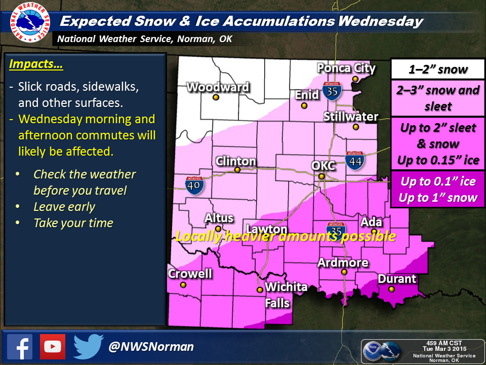
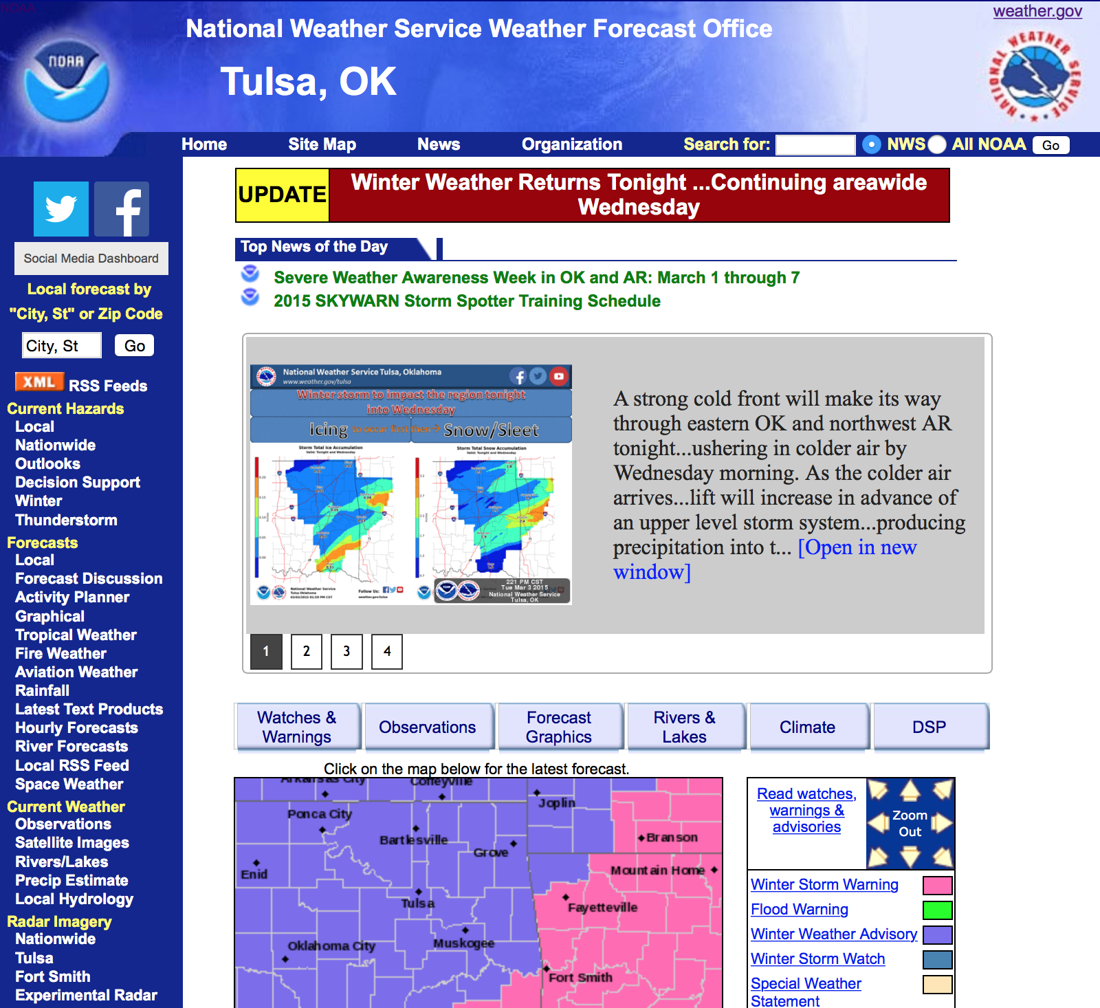
The National Weather Service (NWS) provides regional overviews and products that let you drill down to individual farm or ranch locations. Regional maps give you a broad view of developing weather. These regional maps are updated as needed as weather events unfold. Here are regional map examples from the NWS Tulsa Forecast Office and the NWS Norman Forecast Office showing recent winter storm information.
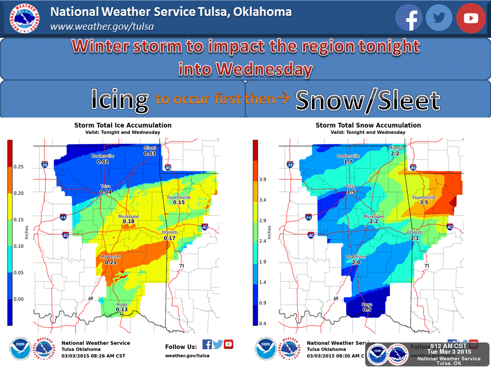
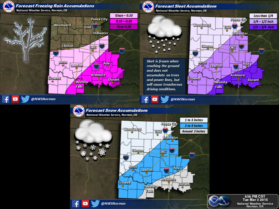
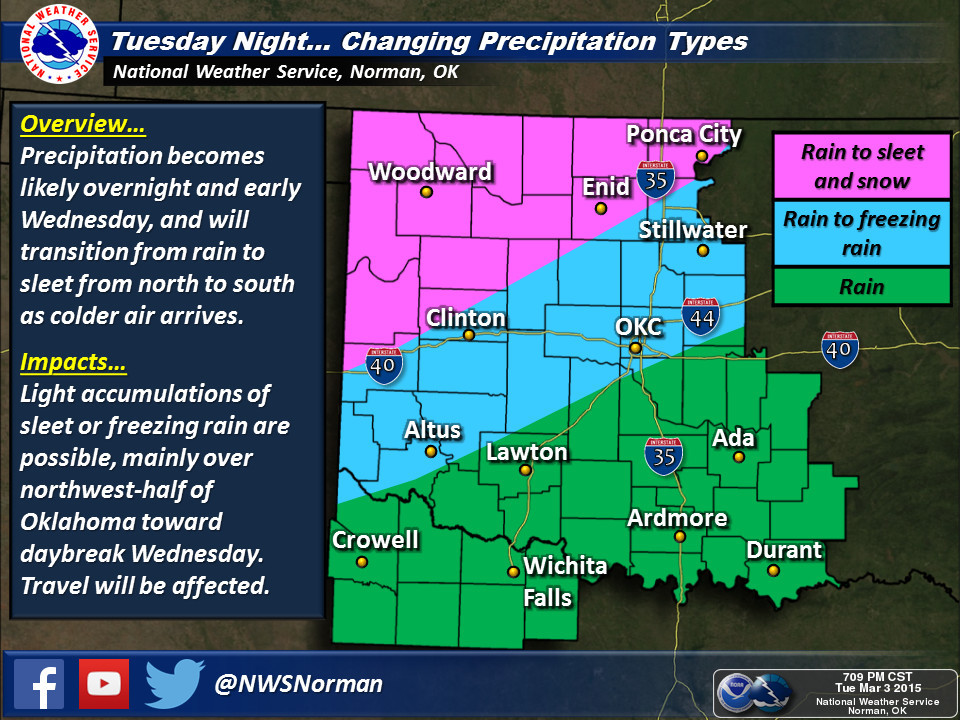
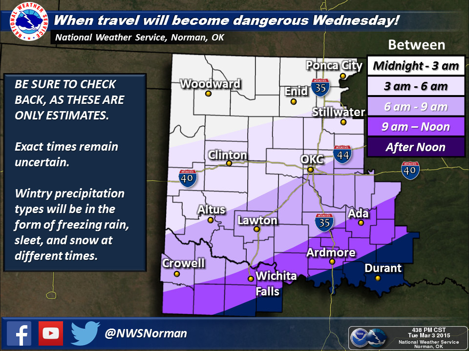
Depending on the NWS Forecast office that serves you and your neighbors, the regional forecast maps are called “Graphicast or Weather Story.” Here are some examples from the NWS Norman Forecast Office that shows how NWS Graphicasts can be used to cover type of precipitation, timing of precipitation, and amount of precipitation.
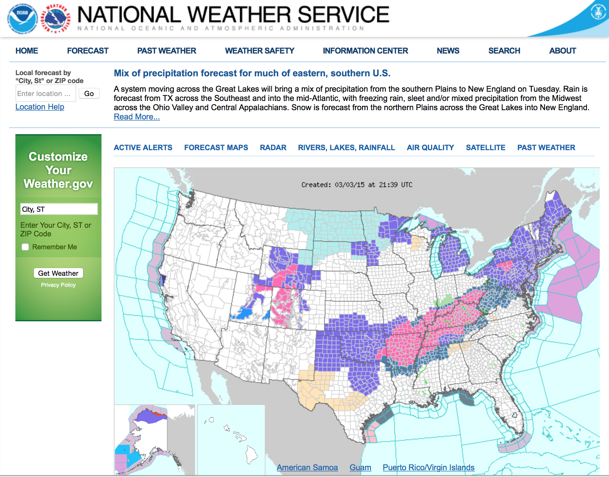
How do you pull up these Graphicasts or Weather Stories? One way is to go to www.weather.gov. This is the National Weather Service’s home page. The displayed national map shows the active warnings, watches, advisories, and special weather statements across the 48 continental USA states, Alaska, and Hawaii. By clicking on the map, you can go to the NWS Forecast Office that serves that location.
Once you get to the NWS Forecast Office you are interested in, you can click on their service area map with city and town names to drill down to your exact location of interest.
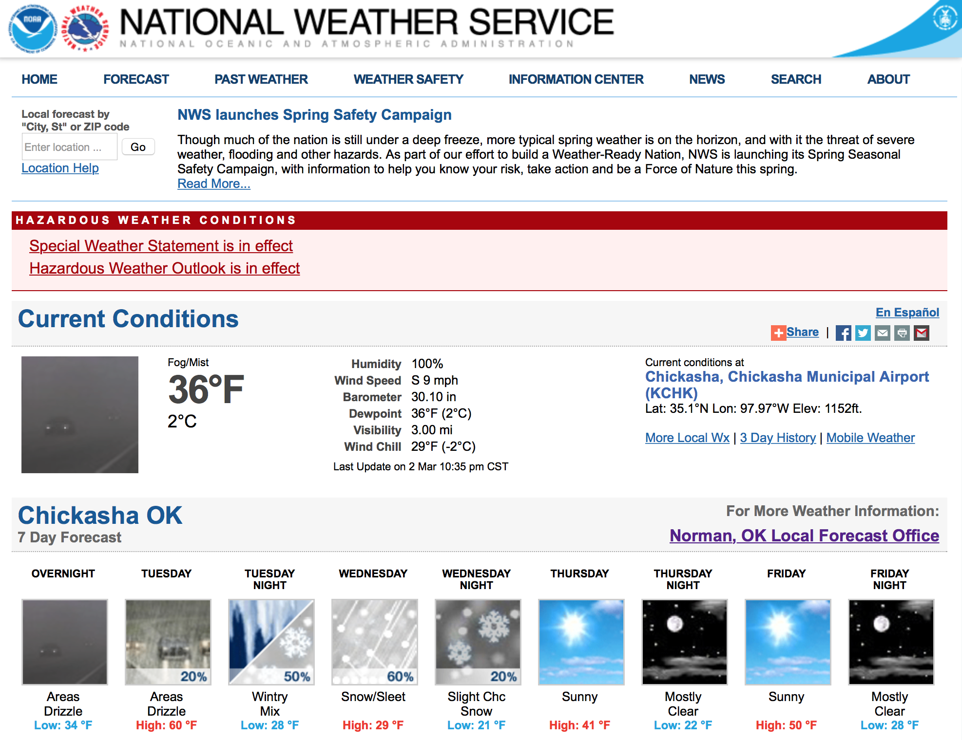
The basic forecast page for any location provides a variety of forecast products. At the top of the page are links to active Hazardous Weather Condition notices in a red highlighted box. These are followed by Current Conditions from the nearest weather station used by the NWS. Next are a series of brief day and night capsule forecasts for a quick forecast check. Down the page, a Detailed Forecast section provides day and night text forecast information over the next seven days. Farther down the page are links to more forecast products and the Hourly Weather Graph.
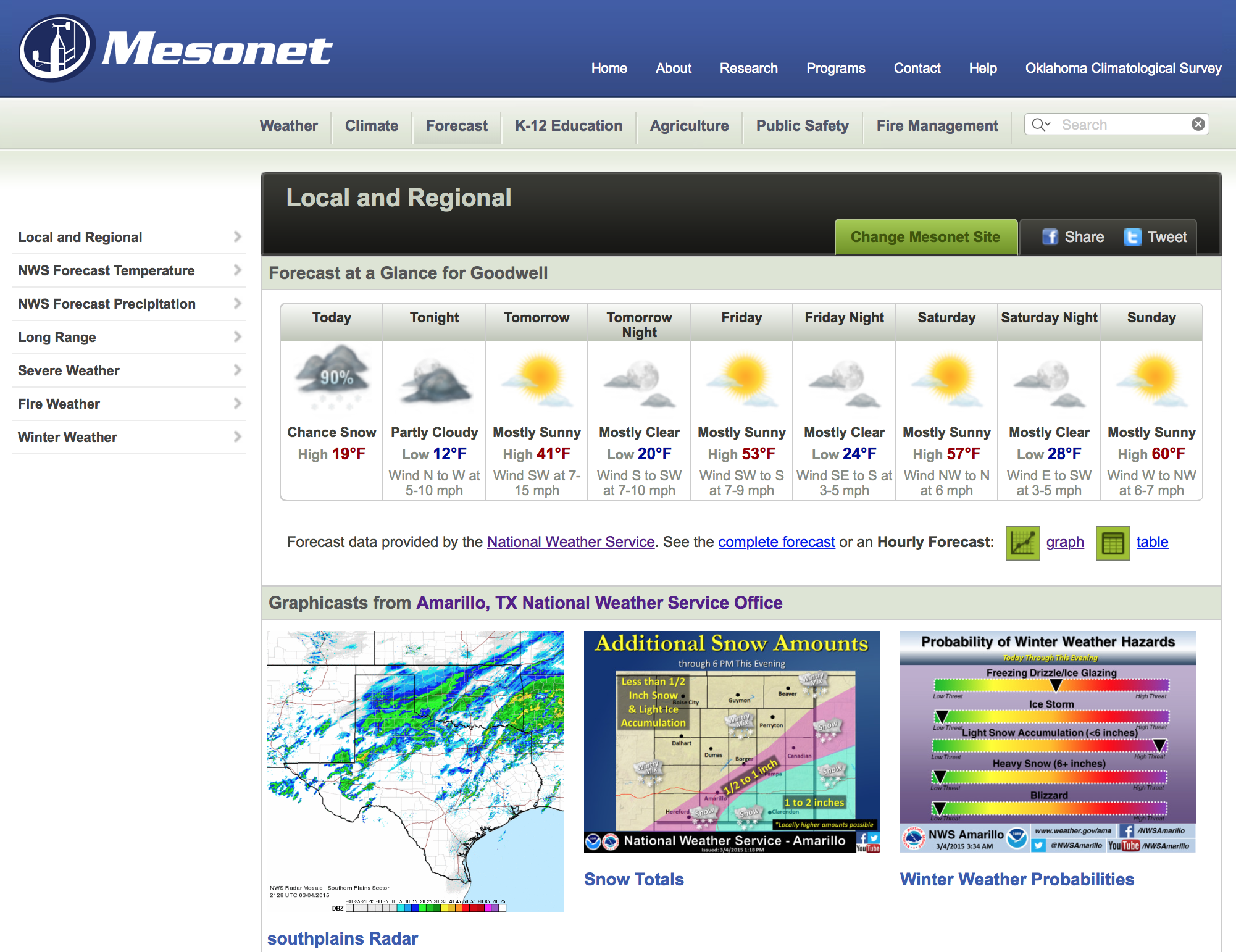
For Oklahomans, another way to get to Graphicasts is to use the Mesonet.org Forecast page. The Graphicasts for the four NWS forecast offices that serve Oklahoma are continuely updated. The thumbnails shown are clickable images.
Hourly Weather Graphs provided by the NWS are a great tool to see ahead hour-by-hour how a storm might impact local conditions. These graphs show air temperature, wind, moisture probabilities, and precipitation types in a series of graphs. This series of graphs are lined up so you can see the forecasted conditions hour-by-hour for all of the forecasted weather variables. The times with grey shadow are at night. Daylight times are white.
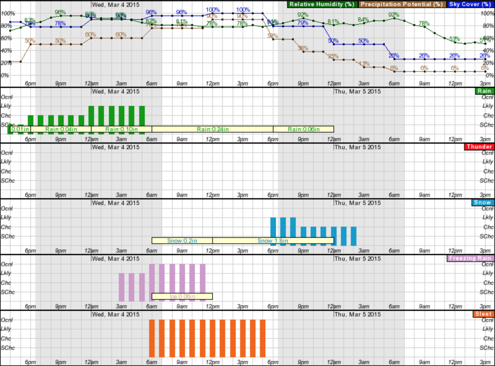
This graph is particularly useful to get a handle on when rain is likely to turn into freezing rain or sleet. It also shows what collection of precipitation types to expect. In the graph above rain turns into freezing rain as early as 3:00 AM, which could last until noon. The chance of changing over to sleet increases at 6:00 AM and continues on to 6:00 PM, when the chance of snow increases. The amounts of each type of precipitation are listed in the yellowish boxes.
Folks who have driven in snow covering a sheet of ice know just how scary and dangerous it is to have so little control over their vehicle. If you haven’t used these National Weather Service products before, check them out and see how they can help you and your family stay safer during winter storms.


Photos: left/KOKH OKC, 2015 and right/KWTV OKC, 2015