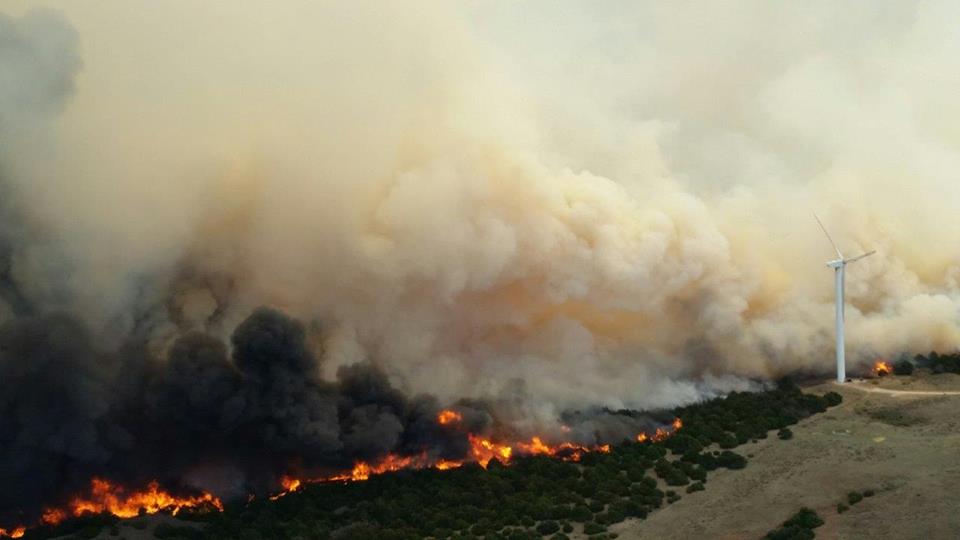
When we have dry, dead grass, low humidity, and strong, gusty winds, it only takes a spark to setoff a disastrous fire. That’s what we had a week ago on Tuesday, April 5th.
(Image: Oklahoma Highway Patrol/Roy Anderson)
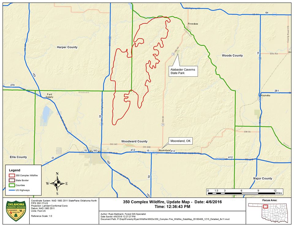
Arcing power lines sparked fires early Tuesday afternoon approximately six miles north of Woodward. Four fires merged into one fire. Firefighters from across the state responded to the call, yet even with the assistance of five aerial tankers by Thursday morning the fire had burned 54,200 acres and was only 10% contained. For this fire, named the 350 Complex, it would be take until the morning of April 11 to reach 80% containment.
What turned an electrical arc into such an intense inferno back on Tuesday, April 5th?
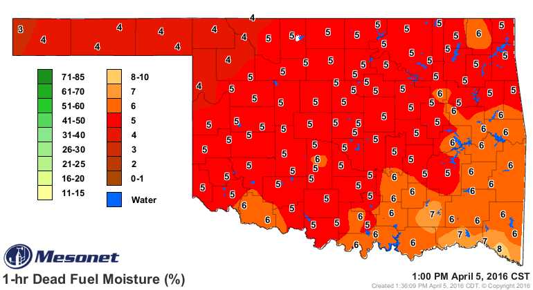
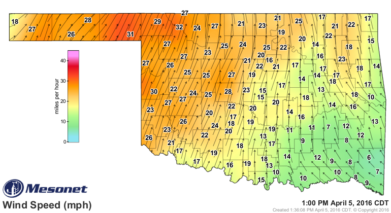
Maps from the Oklahoma Mesonet tell the story. One-hour dead fuel moisture from the Mesonet OK-FIRE gives us the dryness of dead grass stems. At 1:00 PM one-hour dead fuel moisture was a mere 4% where the fire started.
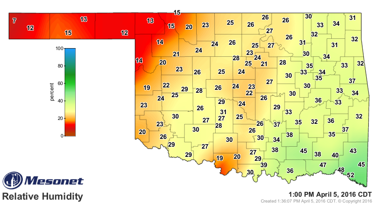
The relative humidity was extremely low. Woodward was 14% at 1:00 PM. Freedom to the north was 15%.
Winds were out of the southwest, averaging 27 miles per hour (mph) at Woodward and thirty-two mph at Freedom at 1:00 PM that afternoon.
At 1:25 PM the Freedom Mesonet site recorded its first 50 mph wind gust. Those high winds blew through the rest of the afternoon. Wind gusts didn’t drop below 40 mph until 10:00 PM Tuesday night. South winds flipped around to the north at 10:15 PM at the Freedom Mesonet site. Wind gusts drop down to 8 mph at 10:30 PM. Within 15 minutes, at 10:45 PM, wind gusts were at 40 mph again, but now out of the north.
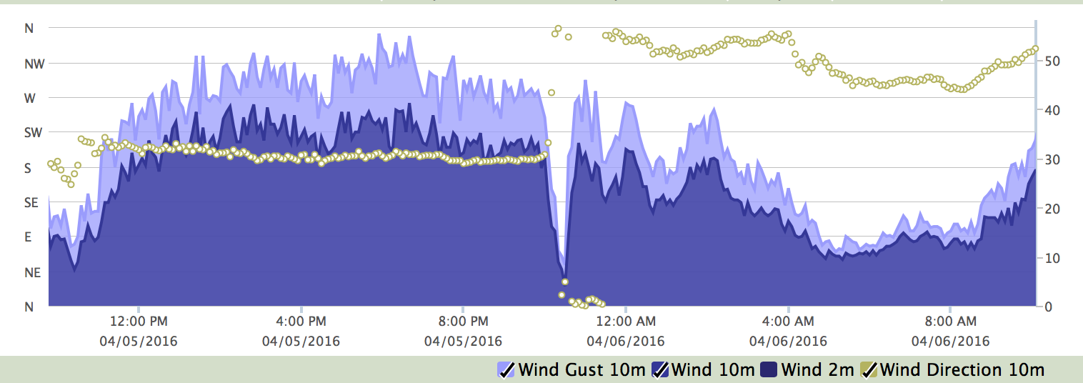
Image: Oklahoma Mesonet Station Meteogram for Freedom, April 5-6, 2016.
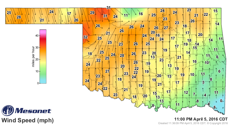
That was at Freedom. Regionally, a wind map for 11:00 PM April 5th shows the multiple wind directions fire fighters had to deal with from the strong wind shift.
By Monday, April 11th, the 350 Complex fire had covered 57,440 acres. Damages for Woodward and Harper Counties were estimated at $2,345,300 by the Woodward Emergency Management office. This included private property losses, public utilities, and government facilities. This cost estimate doesn’t include the fire fighting expenses.
Fire fighters from six states assisted Oklahoma fire fighters in fighting this blaze. They came from Texas, Arkansas, Louisiana, Tennessee, Kentucky and Alabama.
Thanks goes out to all of the in-state and out-of-state crews for their support in putting out the flames.
We are thankful too, that no one was seriously injured or died from this intense, large, week-long fire. There were fire fighters that suffered heat exhaustion and needed medical attention, but no major injuries reported.
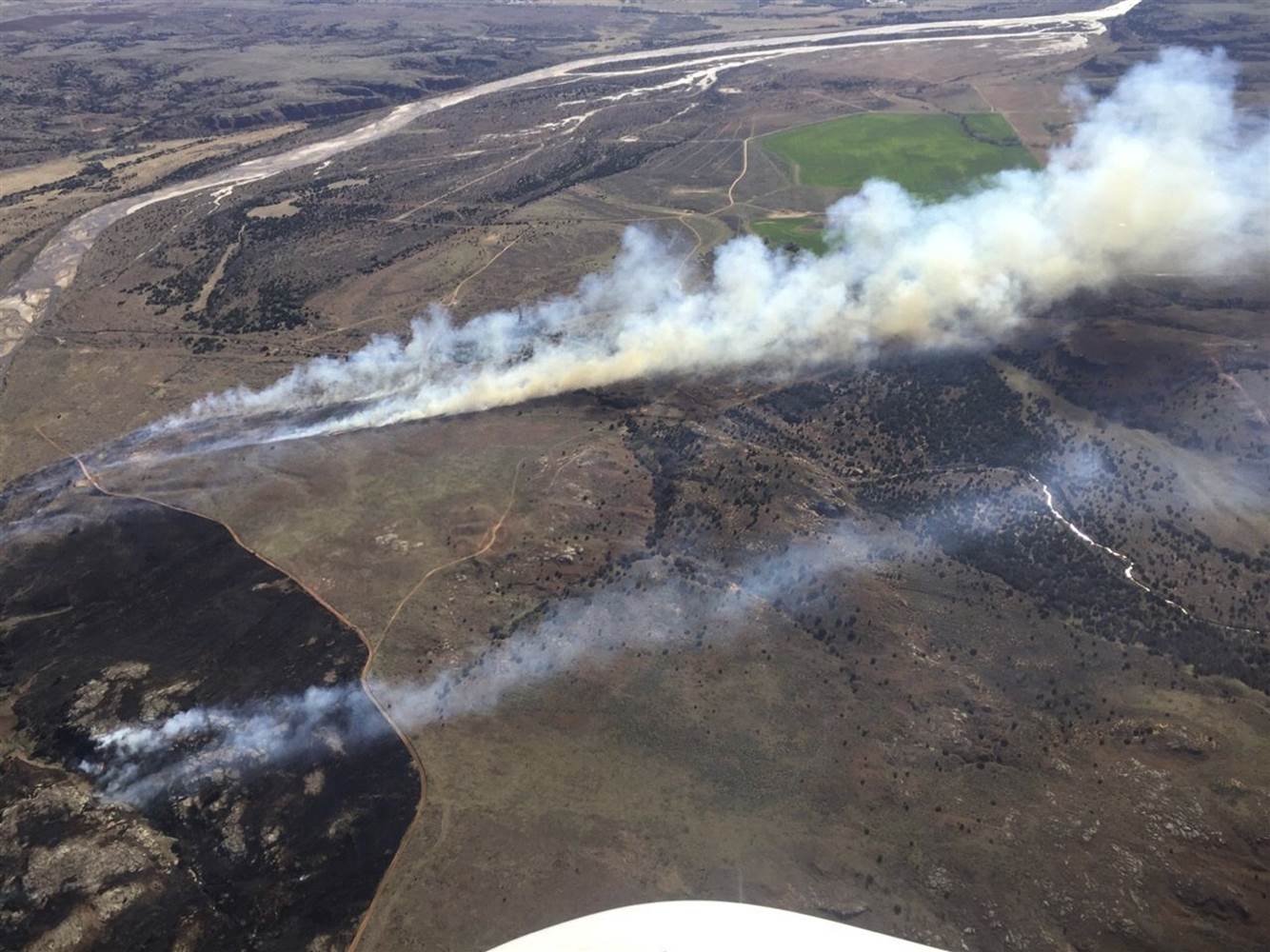
Image: ODAFF Oklahoma Forestry Services
Fire stats source: Oklahoma Forestry Services ‘Fire Situation Reports’ and press releases, April 5-11, 2016.