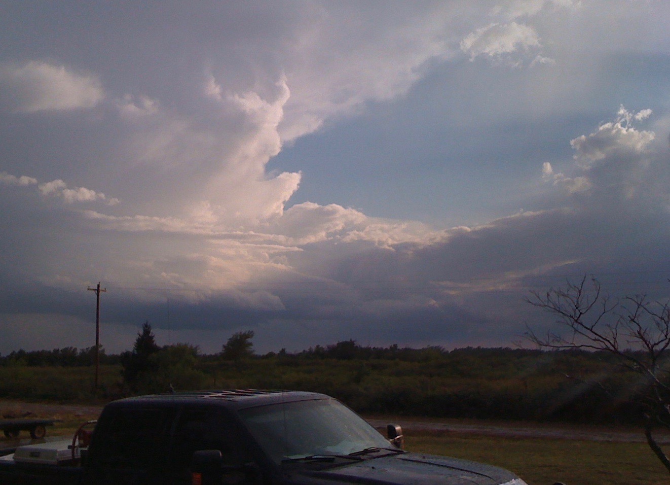
You’re looking out your front door at another storm cloud. You’ve located it on radar. But do those brighter radar colors indicate torrential rain or falling hail. How big is the hail? Can you hit the road or should you wait? Is there any flooding? NOAA National Weather Service text products can help answer your questions.
We have so many storm tools available to us today: radar, satellite, storm trackers, TV coverage, computer Internet access, phone apps.
So why even turn to a text product? Because National Weather Service watches, warnings and advisories issued in a text format verify what you are seeing on radar. They give you the details of timing, location, hazards, impact and precautions you can take. Plus, you won’t have to wait for TV coverage to get back to your location.
If you have the Oklahoma Mesonet Android or iPhone app, you have direct access to the National Weather Service’s text watches, warnings and advisories issued for any county in Oklahoma. The Mesonet apps pull advisories from the four National Weather Service forecast offices that cover Oklahoma.
On the Web, you can get to these advisories by drilling down to your local forecast from the NOAA National Weather Service website, weather.gov.
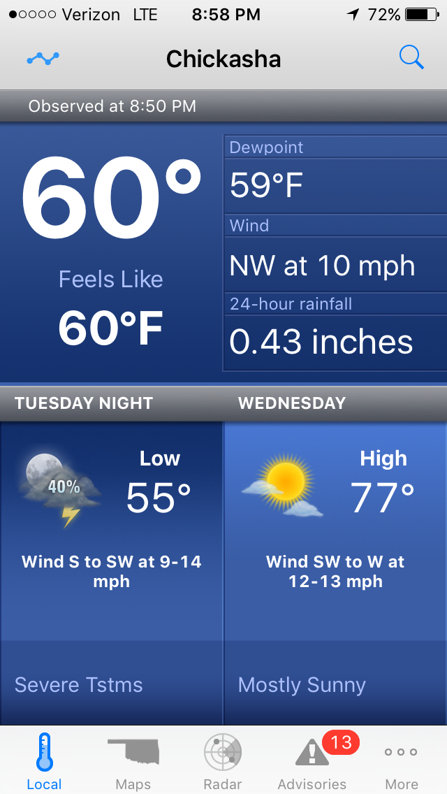
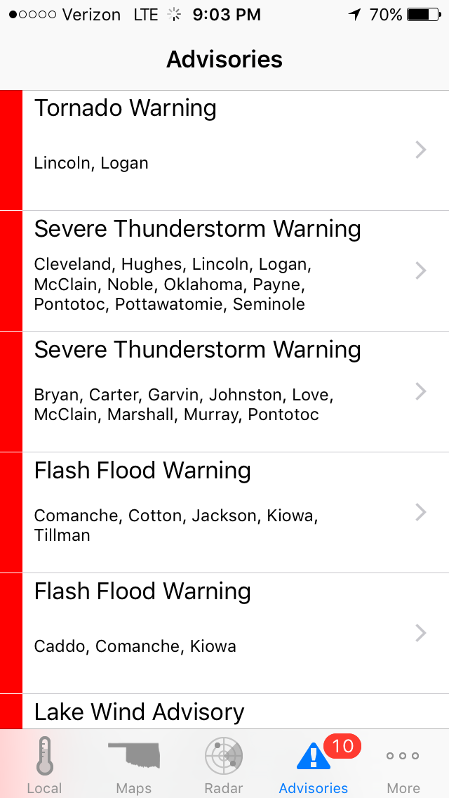
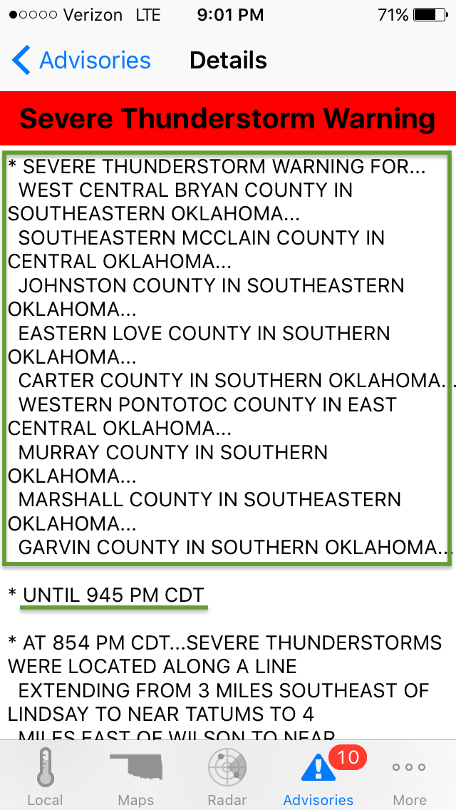
Let’s walk through one of these advisories to see what it offers. This advisory was issued at 8:56 PM Tuesday, April 26, 2016 by the Norman Forecast Office. It was only one of multiple thunderstorm warnings, a tornado warning, flash flood warning and lake wind advisory. Yes, these are the same advisories issued to radio and television stations to inform the public about weather events. The first paragraph doesn’t mean much to us humans, it’s for computer and cataloging purposes.
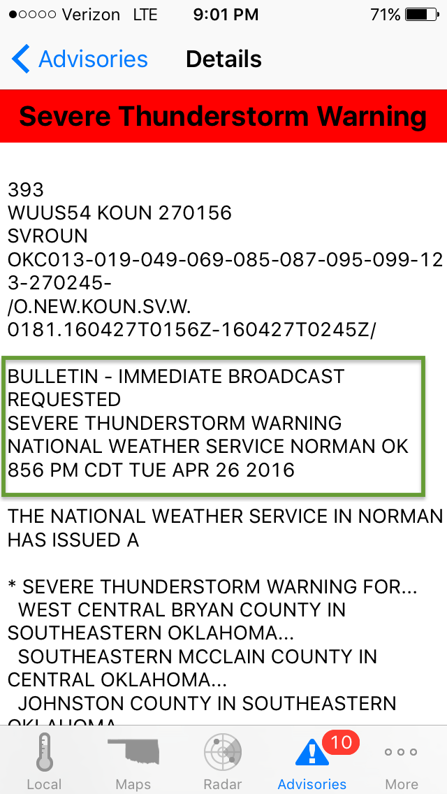
This Severe Thunderstorm Warning was issued for:
- west central Bryan County
- southeastern McClain County
- Johnston County
- eastern Love County
- Carter County
- western Pontotoc County
- Murray County
- Marshall County
- Garvin County
This warning is active until 9:45 PM on April 26th.
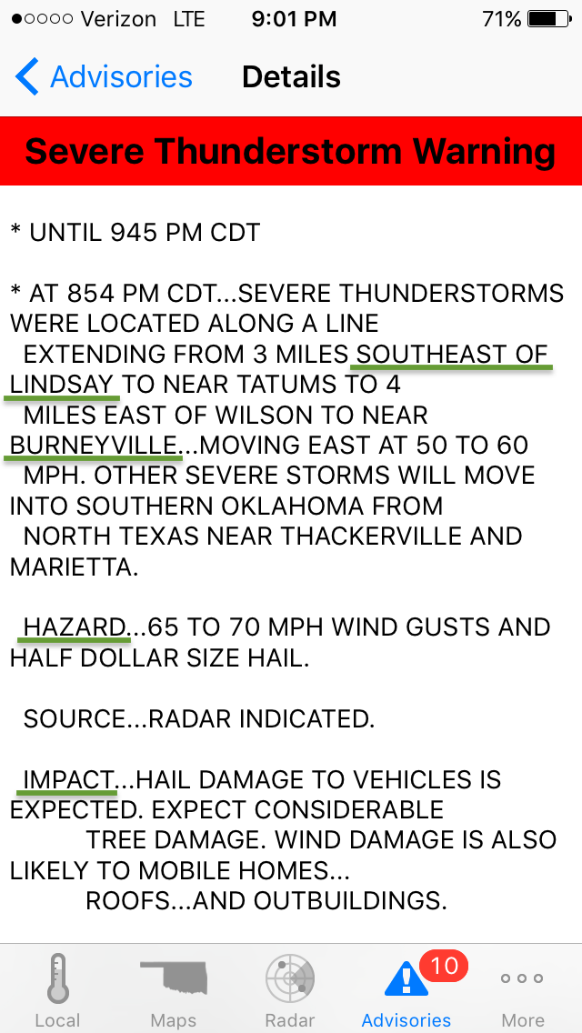
Scrolling down some more we find out that at 8:54 PM thunderstorms were spread out along a line from southeast of Lindsay down to near Burneyville. These storms were rapidly moving east at 50 to 60 miles per hour.
The HAZARD they posed was 65 to 70 mile per hour wind gusts and half dollar size hail.
The anticipated IMPACT was hail damage to vehicles. Wind damage to trees, mobile homes, roofs and outbuildings.
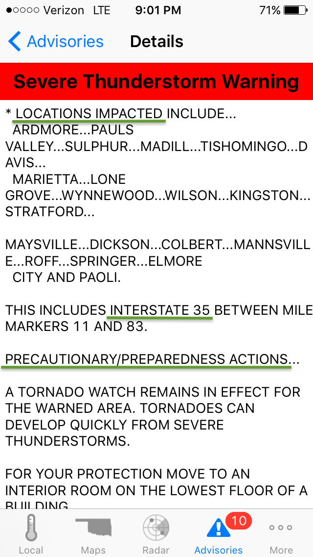
Next, this severe thunderstorm warning lists towns to be impacted and locations between mile markers on Interstate 35. It also suggests precautions and preparedness actions.
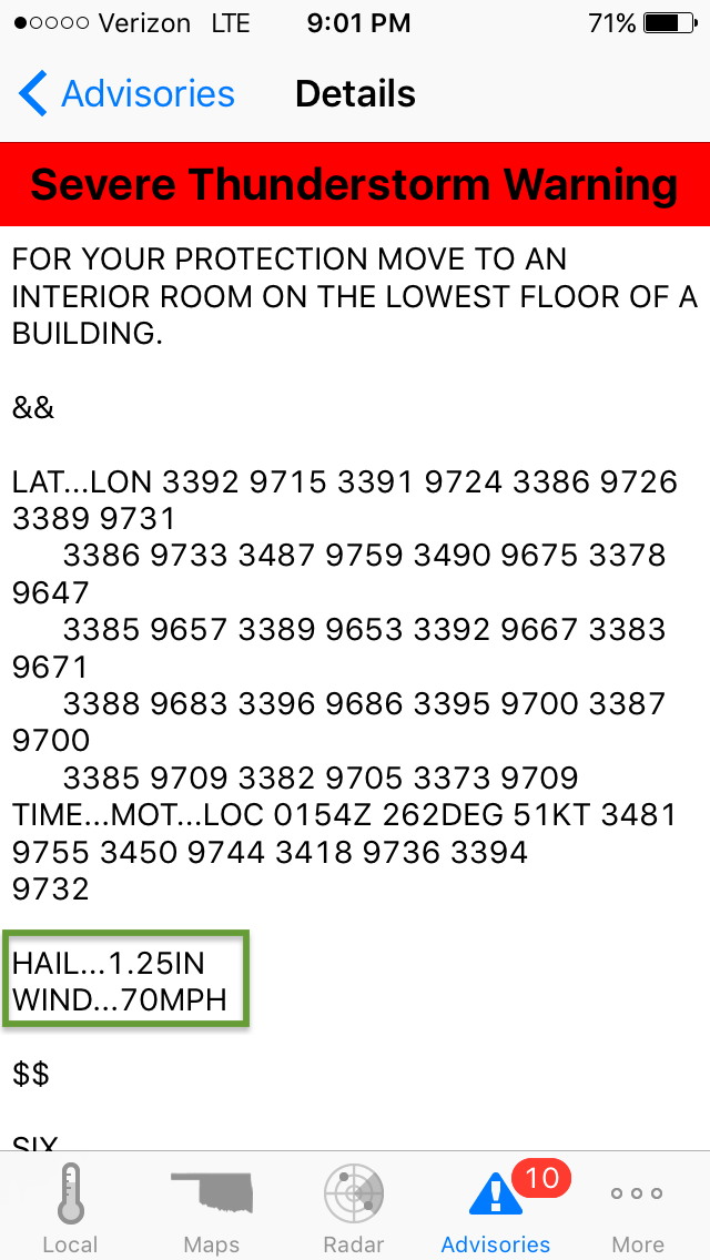
Towards the end, this severe thunderstorm warning lists latitude and longitude coordinates. It ends with the anticipated maximum hail size of 1.25 inches and maximum wind speed of seventy miles per hour.
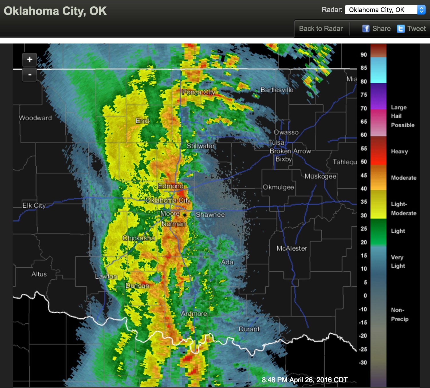
Here is what the radar showed at 8:48 PM Tuesday, April 26, 2016. Remember we just looked at only one of the active text advisories.
Hopefully, this will help you be more comfortable with the National Weather Service text advisories. They are a valuable tool in verifying radar views and media broadcast reports.