January was a month of surprises! We froze from some of the coldest temperatures we’ve seen since 2011, then ended the month basking in spring-like, warm weather.
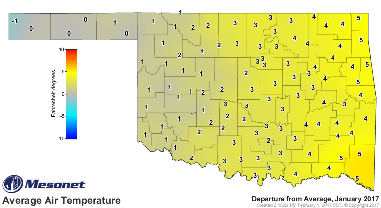
For January, the departure from Oklahoma Mesonet‘s 15-year average air temperatures ranged from 5 degrees above average in the Northeast and Southeast to 1 degree below average at Kenton in the Panhandle. The majority of winter wheat and canola fields were in areas that came in at 1-2 degrees above average.
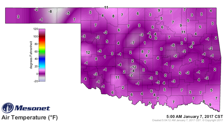
We ended the month with above average air temperatures over the state, even with the frigid days of January 6th and 7th. Here’s the 8 AM Mesonet air temperature map from January 6, 2017, just in case you forgot how cold it was.
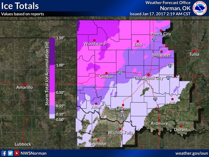
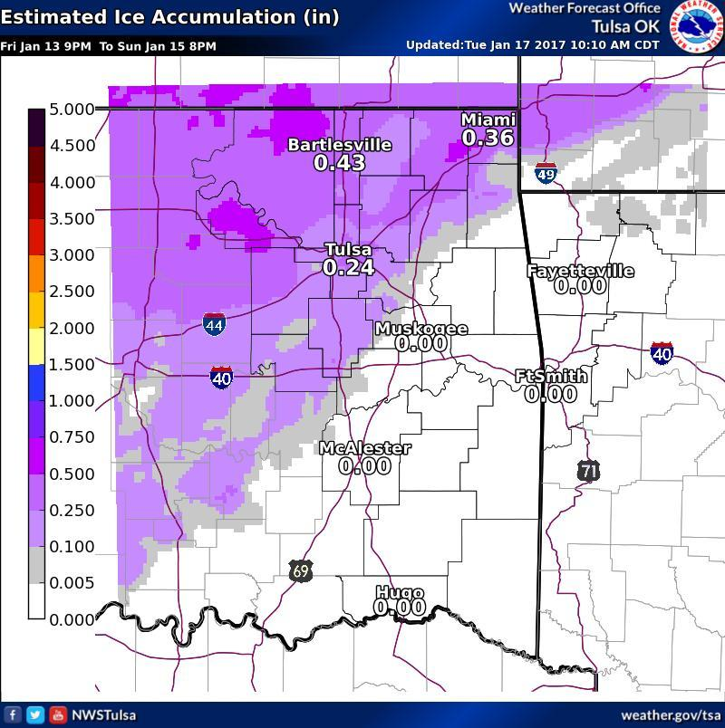
And our ice storm over the weekend of January 14-15th dropped western locations into the deep freeze. Ice total maps are from the NOAA National Weather Service’s Norman and Tulsa Forecast Offices.
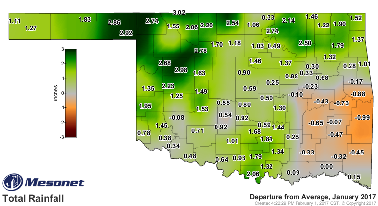
Moisture in January had it’s surprises too. In the west, ice storms came with a lot of moisture. Water from ice melt and rain was enough to push dark green areas 2.5 inches or more above Mesonet’s 15-year averages in January. Light green areas came in closer to 1 inch above average. Grey areas were close to average. The orange areas were below average.
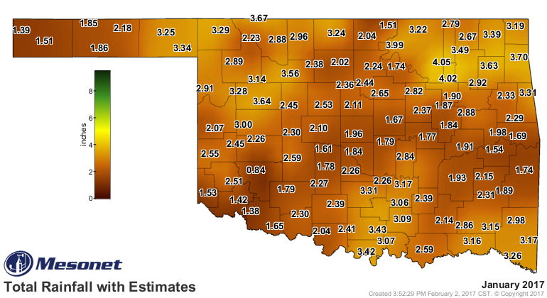
And for those of you wondering about the rainfall total for January 2017, here are the totals for the month that combined ice melt and rainfall.
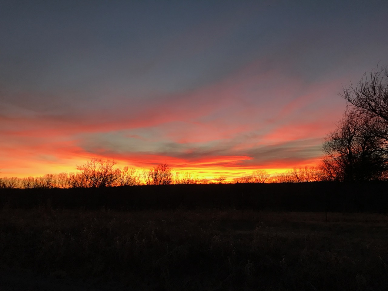
The winners in January were wheat and canola farmers with slightly above average temperatures and critically needed moisture. Thanks January for that moisture. And here is a sunset picture from January 31st. A brilliant end to our first month of 2017!