How does wind impact fire danger? Sunday, January 18, 2015 and Monday, January 19, 2015 provided us a great example of how wind contributes to fire danger. The National Weather Service offices in Norman and Tulsa designated Sunday as a Red Flag Warning fire day. Monday didn’t rate that designation.

The fuel load didn’t change overnight. The relative humidities were similar on both days. That meant the fuel moisture was similar. The air temperatures were similar. The big difference was the wind.
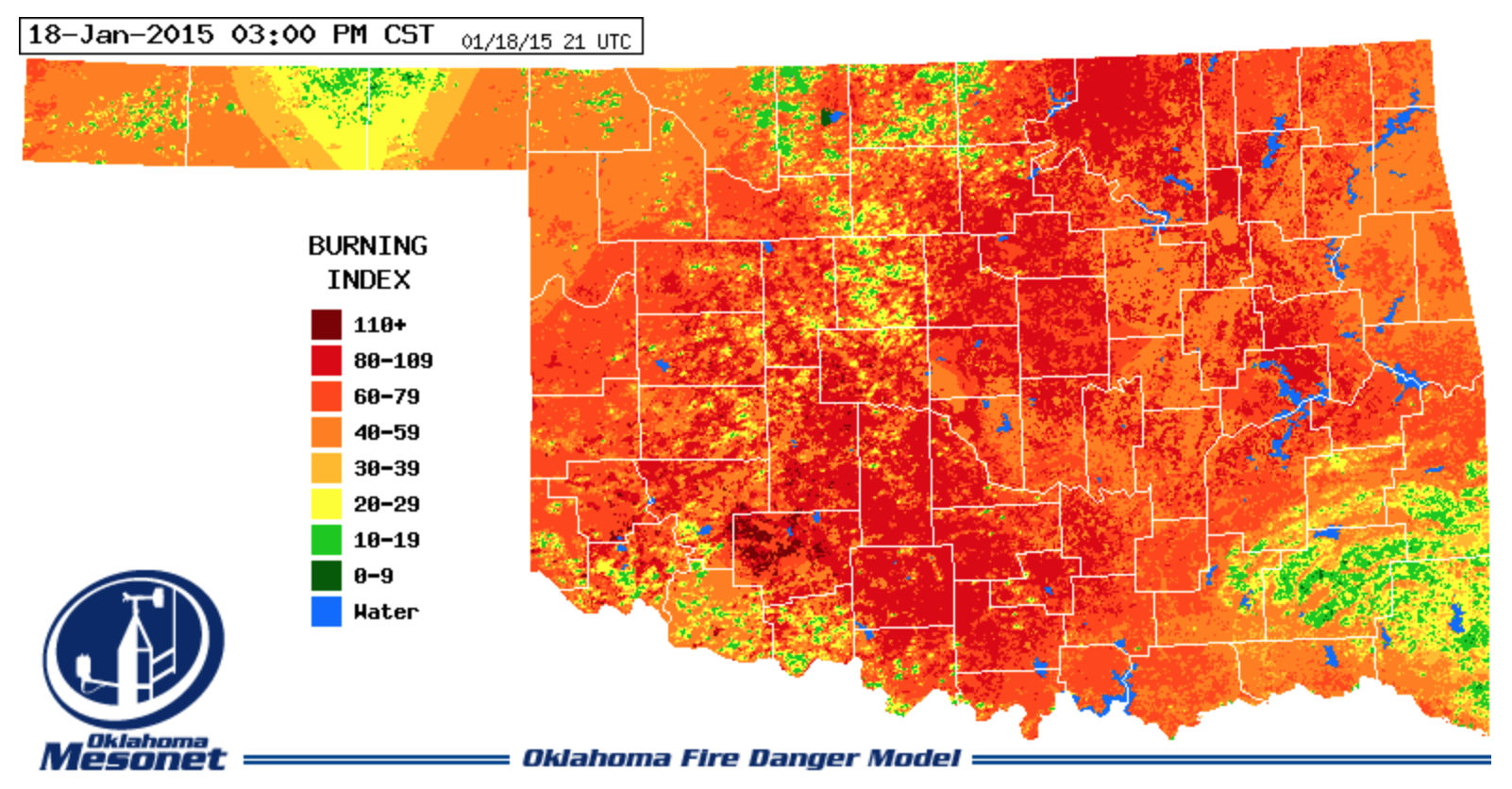
A Burning Index map for Sunday afternoon at 3:00 PM highlights why it was a Red Flag Warning day. Sunday was a day when a number of wildfires popped up across Oklahoma. The bright orange, red, and burgundy colored areas, indicated high fire danger over the majority of the state on Sunday.
Monday, January 19th at 3:00 PM, the Burning Index was much lower, no bright red areas were on the map and most of the state was colored yellow. Burning Index values in yellow colored areas fell into the 20 to 29 index range.
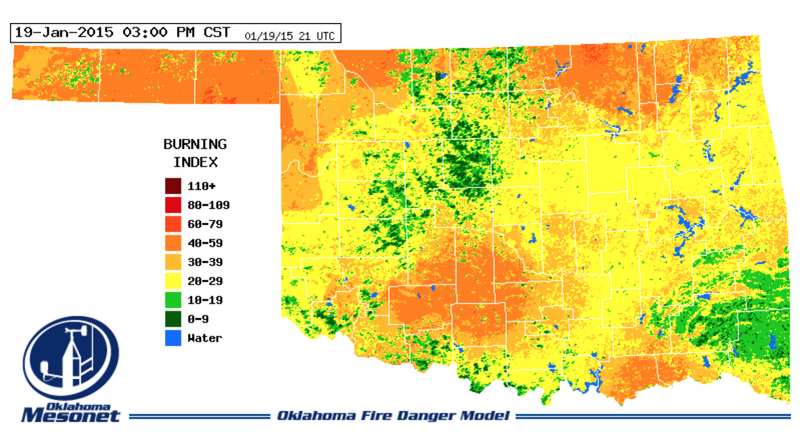
The Burning Index value is not only an index of fire danger. Dividing the Burning Index value by 10 gives an estimate of flame height at the head of the fire. For the bright red areas with Burning Index values between 80 and 109, the estimated flame height would be between 8 and 11 feet. Yellow colored areas have Burning Index values of 20 to 29 would have an estimated flame height of 2-3 feet.
Medicine Park gives us a look at how important the wind can be in driving up fire danger. If we compare the air temperature from Sunday and Monday, both days peaked out close to 70ºF, the red solid fill. Relative humidities were almost the same, 13% on Sunday and 12% on Monday. Sunlight levels were close to maximum on both days.

The big difference between Sunday and Monday was the wind. The light blue fill shows wind gusts on Sunday afternoon were 30 to 35 miles per hour. Monday afternoon wind gusts were 10 to 15 miles per hour.

The Burning Index on Sunday hit a peak of 115 at 4:00 PM. On Monday, the peak was 67 at 1:00 PM.
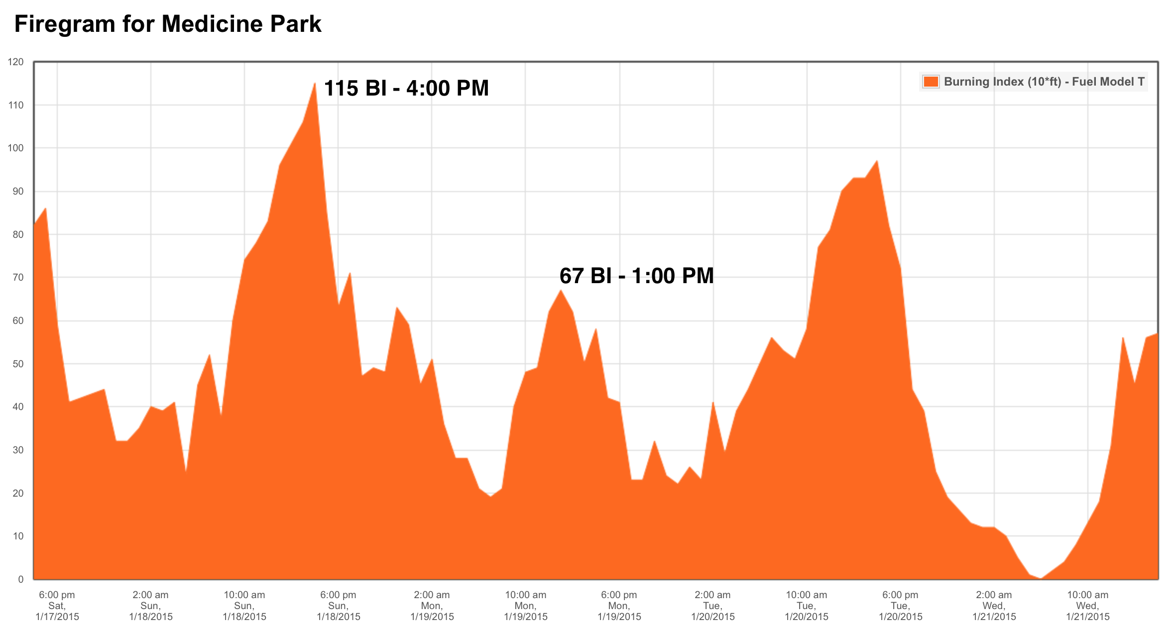
Comparing the Medicine Park wind meteogram to the Burning Index graph, the peak in Sunday’s Burning Index peaked at 4:00 PM then fell off dramatically. The wind peaked too at 4:00 PM and fell off dramatically. The peak wind gust on Sunday was 34 miles per hour.
These two back to back days provided a great example of how wind drives Buning Index Fire Danger.
Mesonet Fire Danger products are produced as components of the OK-FIRE program. The full set of products are available on the OK-FIRE website, okfire.mesonet.org. A limited number of Fire Danger products are available on the Mesonet iPhone and Android apps and on the Mesonet Mobile Website, m.mesonet.org.