What value does a graph line represent? How can a graph of weather data be a risk management tool? Will comparing rainfall to good and bad years help you make better crop decisions?
The difference in Mesonet rainfall graph lines between 2012 and 2014 represented more than a 100 million bushel wheat crop loss for Oklahoma’s farmers. With the wheat price close to $6 a bushel as this article was being written, that’s $600 million dollars in lost grain production by Oklahoma wheat farmers between a good year and a bad year.
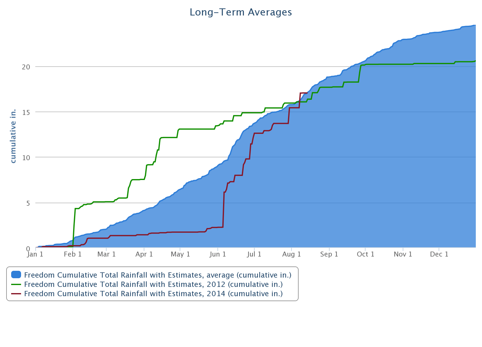
The graph of cumulative rainfall for Freedom for 2012, green line, and 2014, red line, shows the dramatic difference in spring rainfall between these years. The blue fill area is the 15-year average rainfall. The Oklahoma hard red winter wheat crop in 2012 came in at 155 million bushels. In 2014, it was a disasterous 51 million bushels of wheat.
[Full site: mesonet.org / Weather / Past Data & Files / LongTerm Averages - Graphs / Freedom / Rainfall]
At Freedom, the difference between 2012 and 2014 was huge. In 2012, a heavy rain fell in early February, with another significant rain in mid-March. That provided early spring moisture that helped propel the crop to that 155 million bushel state wheat yield.
For much of Oklahoma “Wheat Country” in 2014, the spring rains never showed up. The graph line of 2014 rainfall for Freedom stayed relatively flat until June. The heavy rain in June came too late for wheat plants. What June rain did do was delay harvest and lower grain quality.
Mesonet has a Long-Term Averages – Graphs tool for creating custom graphs. I used the “Add customized data to graph” feature to compare the 15-year average rainfall to 2012 and 2014 rainfall for Freedom and two other Mesonet sites. While the early August cumulative rainfall for 2014 at these three sites had reached the early August 15-year cumulative rainfall average, spring rainfall differed dramatically going from west to east.
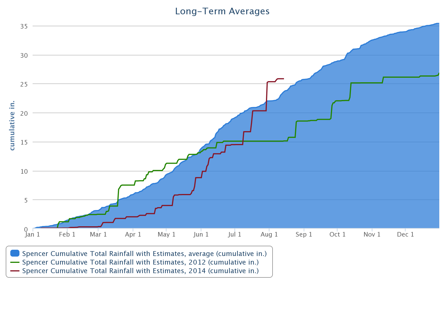
At Spencer in central Oklahoma, 2012 varied little from the 15-year average up until June. In 2014, rain came sooner to Spencer than Freedom. Starting in March 2014, rain fell in small amounts through late April. After that, in May and June, heavier rain events really pushed up the Spencer rainfall. July saw the crossing of the 2012 and 2014 rainfall lines. By the early part of August, the 2014 cumulative rainfall was almost as much as the year end total for 2012.
[Full site: mesonet.org / Weather / Past Data & Files / Long-Term Averages - Graphs / Spencer / Rainfall]
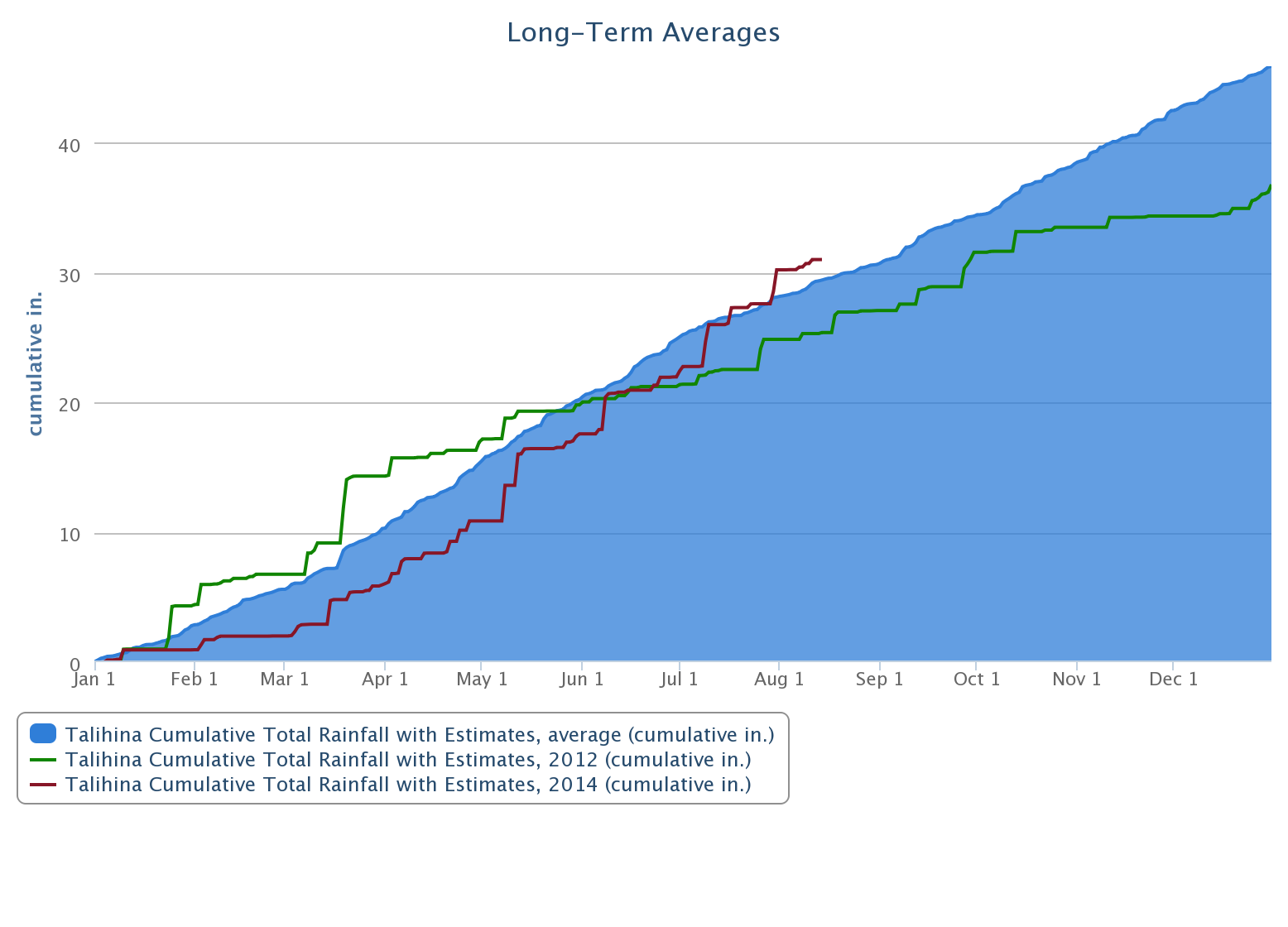
Our third rainfall graph is for Talihina. The differences between 2012, 2014 and the 15-year average are much narrower than the rainfall graphs for Freedom and Spencer. For Talihina, the first significant 2014 rain event came in January. After mid-March there was a steady climb in the rainfall total.
[Full site: mesonet.org / Weather / Past Data & Files / Long-Term Averages - Graphs / Talihina / Rainfall]
These graphs show how different rainfall patterns can be across Oklahoma. They emphasize how “drought” used in a broad sense misses local, important differences in drought impact. While these three sites were close to their average rainfall amounts in August, they varied significantly in the early part of the year.
The Mesonet Long-Term Averages – Graphs is a tool that can be used to compare sixty-three different Mesonet data sets with each other or between years. It allows you to graph daily data and learn so much more than monthly or annual averages can reveal.
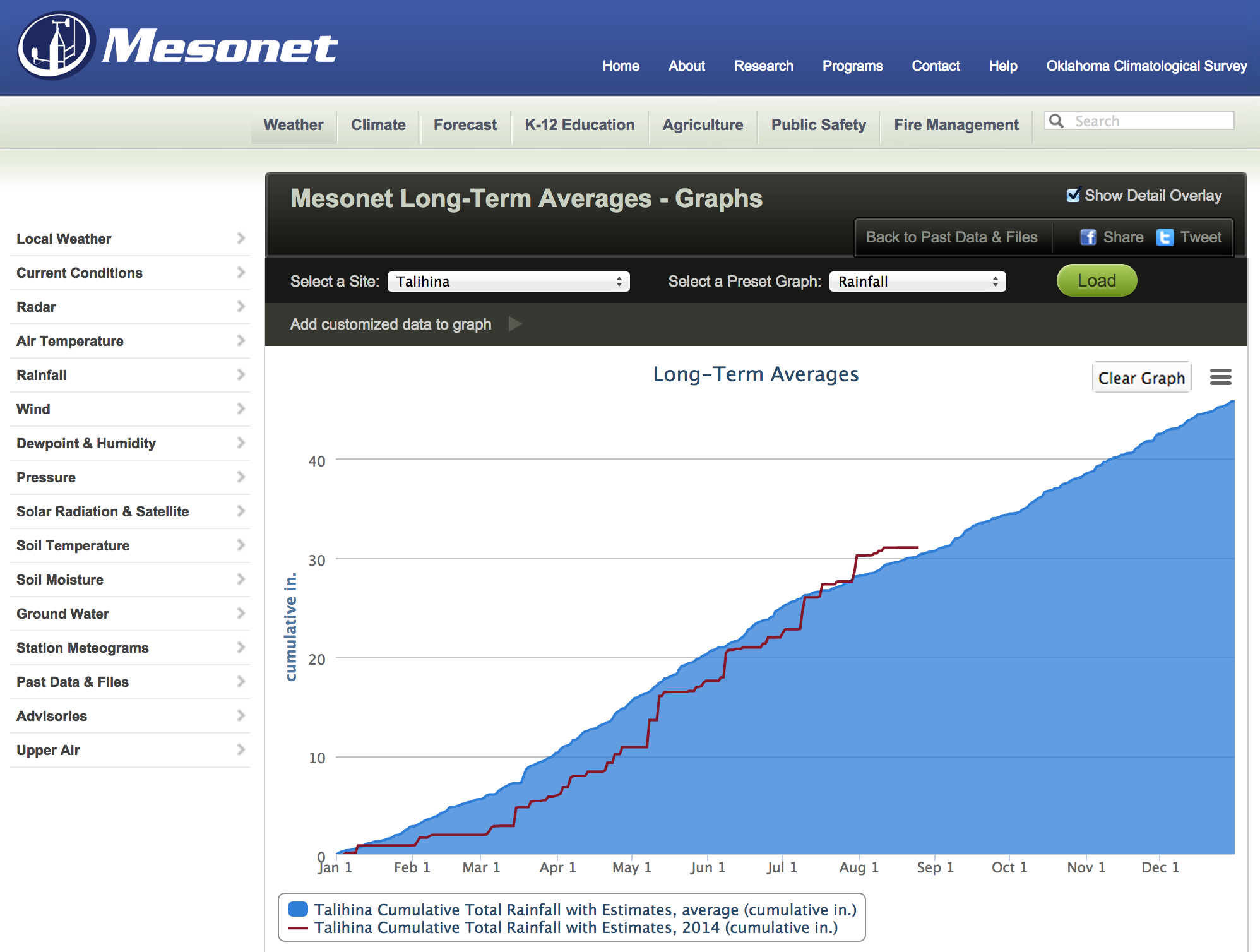
[Full site: mesonet.org / Weather / Past Data & Files / Long-Term Averages - Graphs / Talihina / Rainfall]
That makes the Mesonet Long-Term Averages – Graphs an excellent risk management tool. Producers can compare their best years to their worst years to see how weather contributed to crop yields and forage production. Comparing good and bad years to the current year provides a way to estimate crop yield based on weather drivers. That turns a simple rainfall graph into a powerful risk management tool.