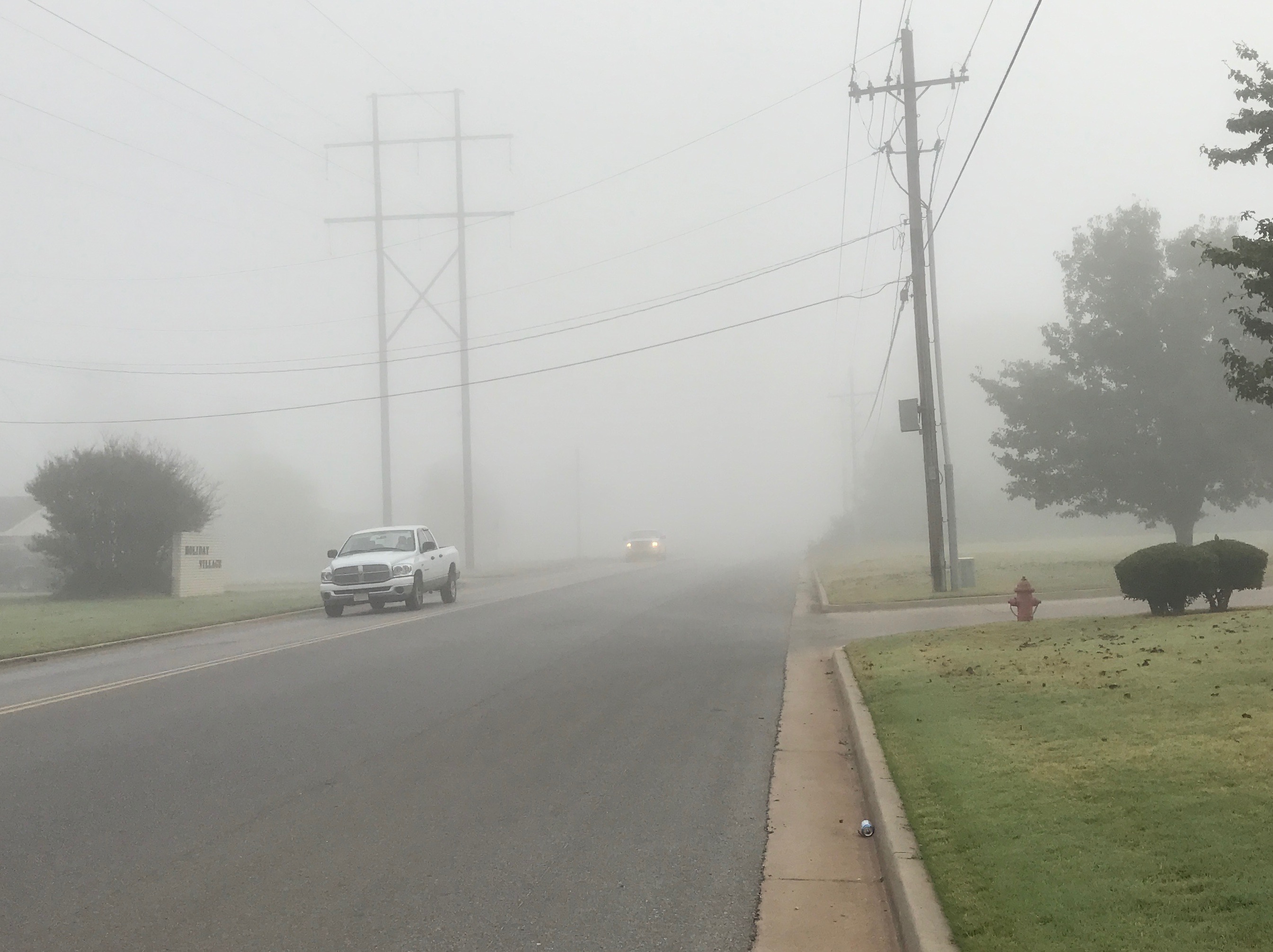
Fog can put a real damper on travel and work plans. Fog slows you down and puts you at greater driving risk. On the farm, fog stops spraying, harvest, and planting. Fog is difficult to forecast. High moisture has to come together with low wind speeds over an extended period of time for radiation fog to set in. The Oklahoma Mesonet recorded those conditions on Thursday morning, October 27, 2016 across Central and Northeastern Oklahoma.
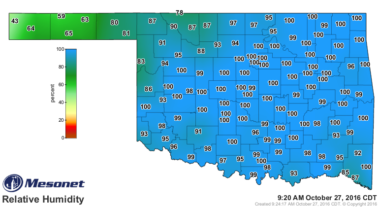
Fog persisted well into the morning. At 9:20 AM the relative humidity maps indicated the likeliest areas of fog. These were the areas where the relative humidities were 100 percent. When the relative humidity is at 100 percent, the air temperature and dewpoint temperatures are the same.
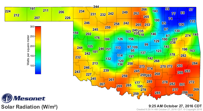
On a map of sunlight intensity, the areas of denser fog at 9:25 AM were the blue colored areas with solar radiation below 150 watts per meter squared.
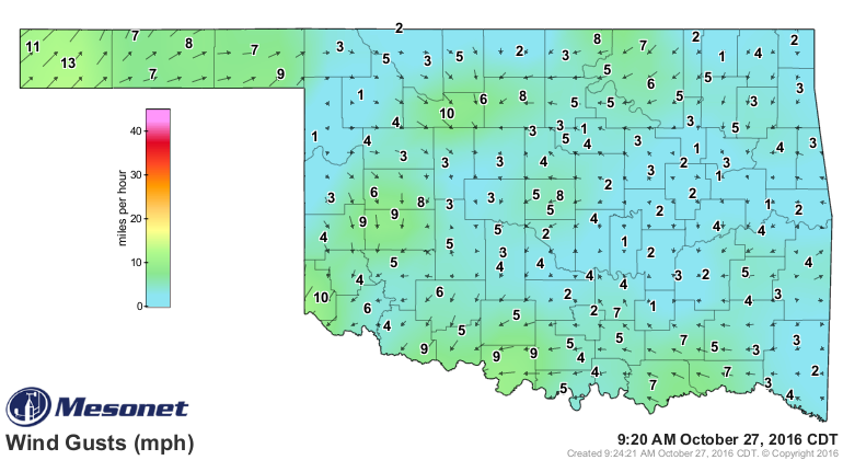
The average wind speeds across the state at 9:20 AM were extremely low. Look at all of the Mesonet sites reporting less than 3 miles per hour average wind speed.
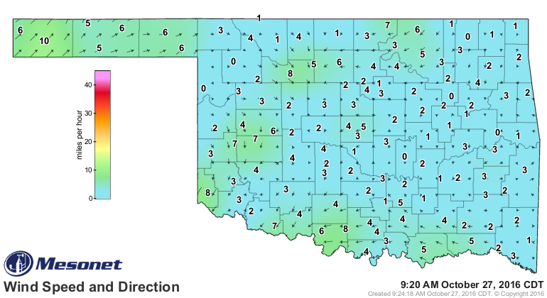
And wind gusts were only slightly higher.
These conditions lasted for hours. On a graph of air temperature, dewpoint temperature, and wind speeds at Shawnee, we can see how conditions conducive to fog began an hour before midnight and continued throughout the early morning hours. It was close to 11 PM when the air temperature cooled to the dewpoint temperature and after that the pink air temperature chart was hidden behind the green dewpoint temperature chart fill-line.
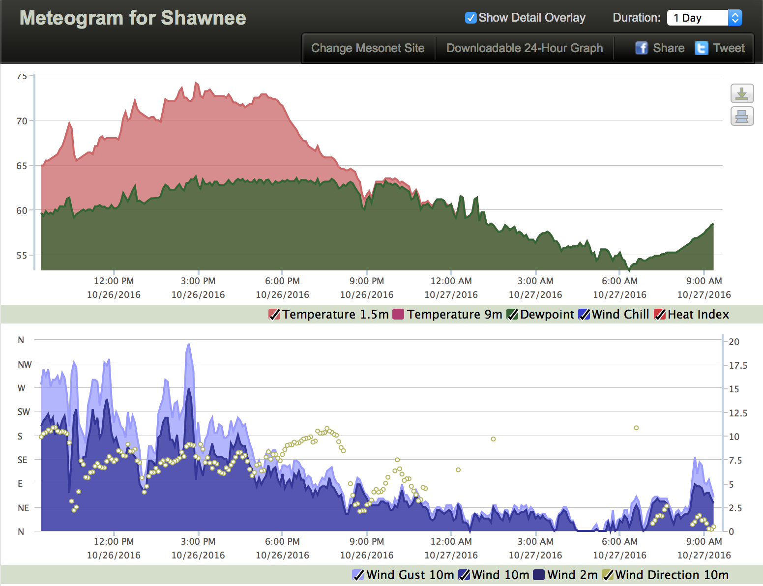
The wind speed and gusts dropped below 2.5 miles per hour speeds an hour before midnight. There was even an hour before dawn when the wind dropped to zero. And those low wind speeds made it impossible to set a wind direction, so the gold direction circles indicating wind direction disappeared.
Compare those charts to Tuesday morning at Chickasha, when the air temperature and dewpoint temperature came together for a brief time. That was a morning when dew formed on vehicles and structures, but no fog occurred.

This is another example of how Oklahoma Mesonet data can be used to understand what weather conditions lead to different weather situations. It’s a great example of how Mesonet data can let us know where we’re likely to run into weather conditions that alter travel and work.