The offense moves first, seeking to confuse, elude, to cut through the defense. If the defense plans well and plays well, each player is in position to stop the one with the ball. Now the outcome hinges on the basics. All of the planning, practice comes down to executing tackling basics.
Collecting rainfall is basic to monitoring weather. Measuring it accurately is like making that open field tackle. Correct rainfall amounts are valuable data for weather records, for climate records. Done wrong, bad data leads to wrong decisions. Done sloppily, it misleads.
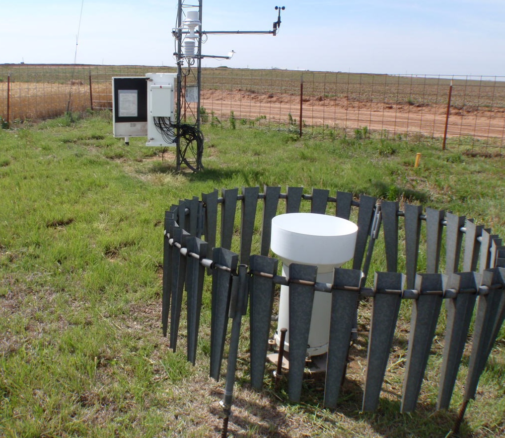
An accurate rain gauge is basic to rainfall record keeping. Some folks point to radar data as an alternative. Is it? Radar can catch rain where there is no rain gauge. So radar can replace rain gauges, right? With its own set of pluses and minuses, radar has not become a replacement for rain gauges, nor are rain gauges alone the best way to report rainfall.
We’ve learned that rainfall amounts across an area are most accurately assessed when rain gauges are used to ground truth radar data. The blend of basic, accurate, local rain collection with the sophistication of radar, is like that football team that has a great defensive scheme and players that execute basic tackling skills perfectly to down the ball.
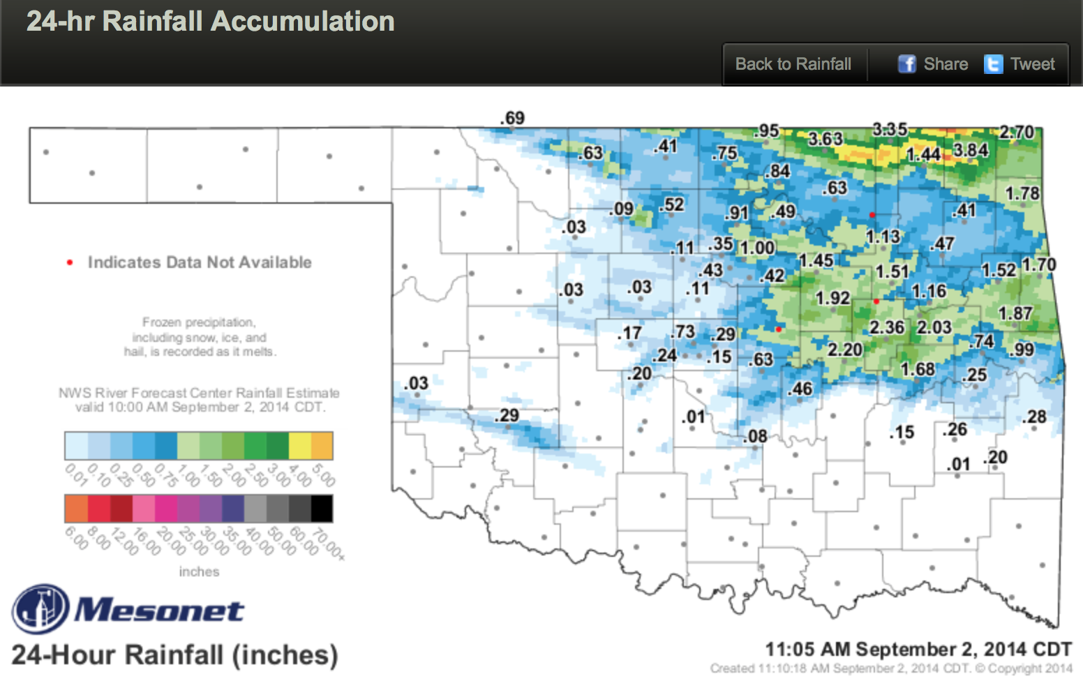
Mapped radar rainfall ranges show where amounts vary between rain gauge locations. Radar can catch isolated, intense rain storms or those nearby areas that received little or no rain. On the 24-hour map below, the yellow areas had over 4 inches, the light orange over 5 inches, and the dark orange over 6 inches. The highest Mesonet site, Vinita, recorded 3.84 inches. Nearby Nowata, only 1.44 inches.
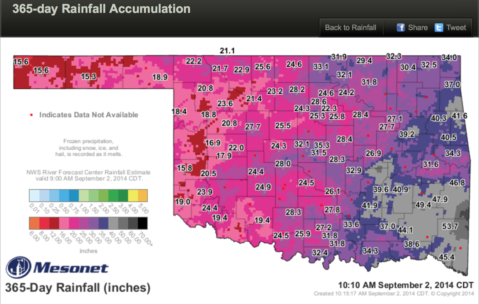
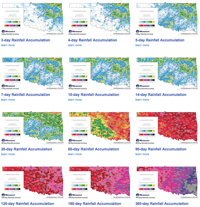
The Oklahoma Mesonet has partnered with the National Weather Service Arkansas-Red Basin River Forecast Center to combine rain gauge data with radar rainfall estimates. The River Forest Center uses Oklahoma Mesonet rain gauge data to verify radar rainfall amounts and adjust them, so the radar reflectivity more accurately depicts rainfall amounts. Combining both rain gauges and radar on the same map gives a more accurate picture of rainfall across the state.
The values on Oklahoma Mesonet rainfall maps are Mesonet rain gauge data. The grey dots are Mesonet tower locations. Red dots are sites where current rain data for the map time period is not available. The River Forecast Center radar rainfall estimates are the map colors. The rainfall color ranges show estimated rainfall at and between rain gauge locations.
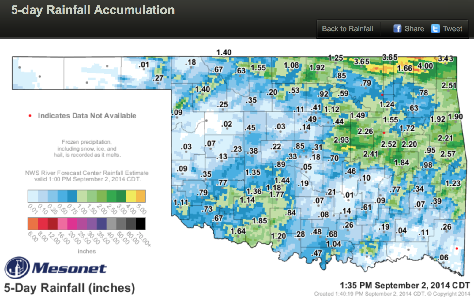
Mesonet has eighteen rainfall maps. They show rain collected for as short a time as the last hour, all the way out to the last 365 days. All rainfall maps and webpage navigation thumbnails are updated every 5 minutes.
As sophisticated as we and technology gets, we still need to stay solid on the basics.