So when does fall begin? From a farming, ranching, gardening standpoint, it’s when air temperatures drop into mild ranges and water demand tapers off. It’s when plants respond with their fall flush of growth. Animals respond by playing more. Livestock gain more. And the kids quit asking if we’re there yet!
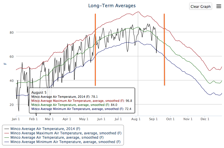
If we just consider minimum air temperature as a season mark, we could turn to a long-term averages graph for our dates. This graph from Minco, in central Oklahoma, has two orange lines that highlight the average dates when the minimum air temperature crosses 60 degrees F. We could use these to mark the beginning of summer and the beginning of fall.
[Full site: mesonet.org / weather / past data & files / long-term averages - graphs]
For Minco, these dates fall on May 22nd and September 19th. Summer heat climbs to a peak on August 5th for air temperature averages based on the 15-year Oklahoma Mesonet average of the maximum, average and minimum daily air temperatures. On August 5th, the maximum average peak is 97 degree F, average is 84 degrees, and minimum average is 72 degrees.
What if we expand what weather might measure the beginning and end of summer? Maybe it’s an average daily air temperature of 70 degrees F? Or when the average daily maximum hits 80 degrees?
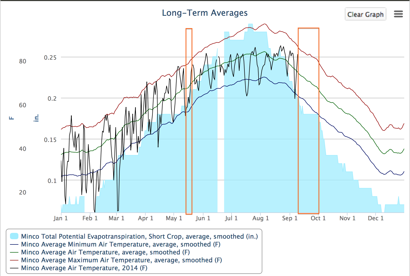
What else might signal summer-like plant growth conditions? How about when the Reference Short Crop Evapotranspiration hits two-tenths of an inch per day? (Trivia answer: Evapotranspiration is the combination of water that evaporates from the soil surface and water that plants release from their leaves, transpiration. Short crop represents a 4-inch cut grass.)
What is interesting is that when we compare dates for these thresholds for air temperature averages and two-tenths evapotranspiration, the date ranges that capture all these thresholds is much narrower in the spring than in the fall.
[Full site: mesonet.org / weather / past data & files / long-term averages - graphs]
Our air temperature and evapotranspiration box is narrow over mid-May. Later at the time we think of as fall in Oklahoma, it covers slightly more than the last three weeks in September. What that indicates is that plant and animal responses in the fall will occur over a longer time.
Maybe this broader range is why we can come up short on caring for plants in the fall. Why we need to be ready to irrigate or water again. We may have already set our mind to fall based on the calendar, only to be surprised by the weather. Tuesday was a day that took a toll on plants. Potential water demand ranged from 0.17 at Broken Bow to 0.38 inches at Beaver.
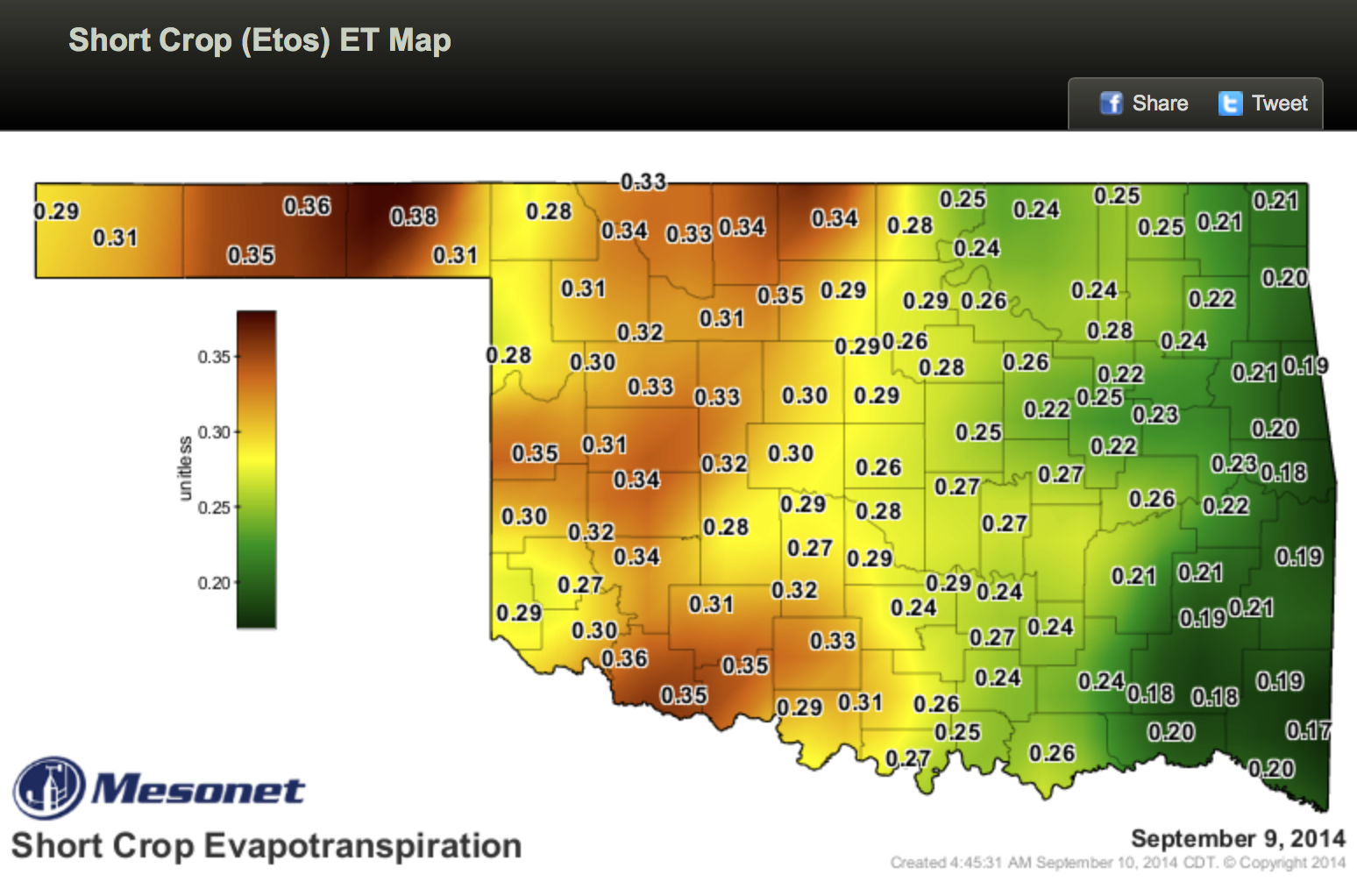
[Full site: mesonet.org / agriculture / evapotranspiration / short crop (ETos) ET map]
The air temperatures were definitely summer-like, 89 to 100 degrees F. Grandfield added one more 100 degree day to it’s summer count.
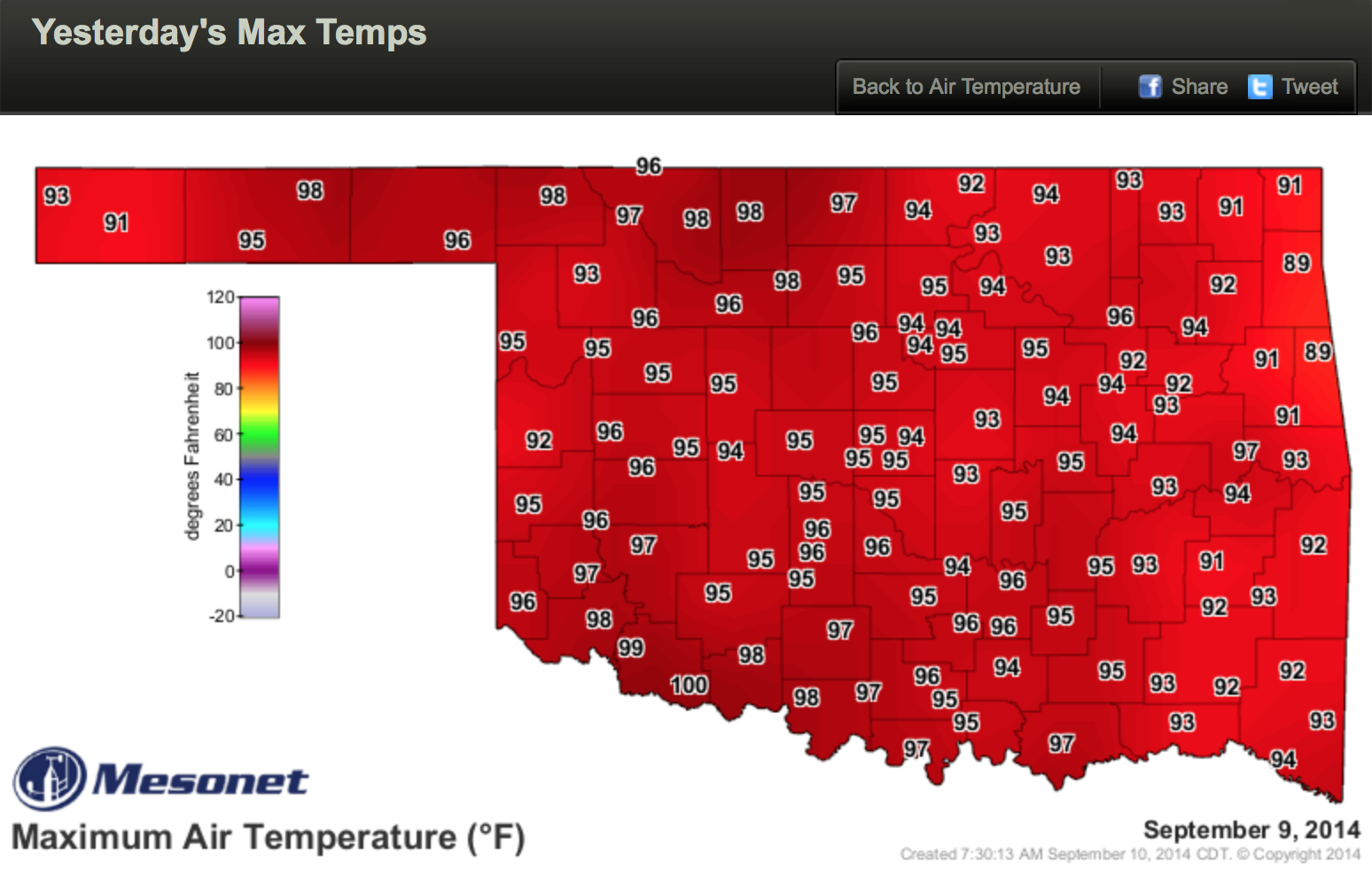
[Full site: mesonet.org / weather / air temperature / yesterday's max temp]
[App: maps / air temperature / yesterday's max temps]
Those high potential water demand values from the calculated reference short crop evapotranspiration came from high winds on top of the high air temperatures.
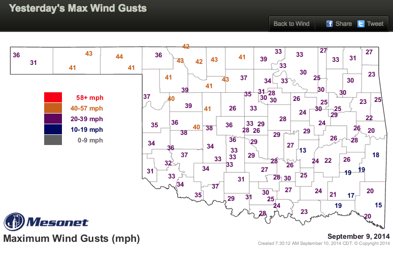
[Full site: mesonet.org / weather / wind / yesterday's max wind gusts]
[App: maps / wind / yesterday's max wind gusts]
So fall is a time that can surprise us. A good reason to check out the forecasts more often.
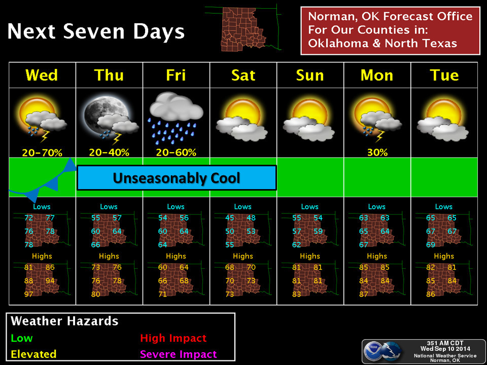
As we look ahead on the afternoon of Wednesday, September 10th, 2014, it looks like fall weather is here for the next week. The Next Seven Days forecast from the National Weather Service’s Norman Forecast Office points to lows below 60 degrees and highs below 80 degrees for a number of days ahead. That forecast takes us out through September 16th.
[Full site: mesonet.org / forecast]
So is fall here yet? Almost, but not quite. Let those little ones in the back seat sleep a little longer.